
A Primer on Flood Mitigation
In the United States, floods (the periodic overflow of streams, rivers, basins or drainage systems) are the leading cause of natural-disaster losses – they consist of more than 75 percent of all Federal disasters, result in an average loss of $8 billion annually, and cause more than 90 fatalities per year (USGS). Flood mitigation describes preemptive actions or strategies that can be taken to reduce the risk and impacts of flooding to specific areas or structures before the next disaster occurs. Implementing flood mitigation strategies can help better protect life, culture and property.
The types of mitigation strategies that are implemented can vary greatly depending on many factors, including the context of the flooding risk, the environment, vulnerability, capacity of resources, desired outcomes, and future planning scenarios. Examples of flood mitigation strategies for a community include developing mitigation plans, planning/zoning efforts, incorporating requirements into local building codes, floodplain and watershed management, and education/outreach programs. At the household level, flood mitigation strategies may include actions taken during construction and property improvements (drainage, lot grading, reducing impervious surfaces).
Approaches to flood mitigation can often be categorized as nonstructural or structural. Structural mitigation strategies refer to construction projects that produce physical changes to reduce or avoid impacts of hazards. In the case of flooding, example structural mitigation strategies include levees, shoreline buffers, sandbags, home improvements and retrofits (wet flood-proofing and dry flood-proofing methods), and elevating or relocating structures. Non-structural mitigation strategies refer to measures taken that do not involve physical changes or construction; instead, the impacts of flooding are reduced or avoided through policies (such as steering away development from hazard prone areas), awareness and educational programs, training, and flood insurance. Both structural and non-structural mitigation strategies are integral in improving community readiness and preparedness in the face of flooding events, and often, these types of strategies are best utilized in tangent with one another.
Flood Risk Probability
What is Flood Mitigation?
Understanding Flood Risk in Western Upper Peninsula of Michigan
Living on the nation’s longest freshwater coastline can come with its challenges. The 2013-18 hazard mitigation plans for Baraga and Houghton counties warned about moderate to severe risk of riverine and urban flooding and high and very-high risk for shoreline flooding and erosion in a number of areas. In June of 2018, widespread and historic levels of flooding, known as the Father’s Day Flood, severely impacted Michigan’s western Upper Peninsula, spurring Governor Rick Snyder to declare a state of emergency. Looking towards the future, the 2020-25 Houghton County Hazard Mitigation Plan describes flood risks similar to the previous plan but with an additional warning about the impacts of climate change and intensifying development which may increase the frequency and severity of flooding. Tools to assess flood risk within an area of interest include looking at maps that provide inundation depth (flood water levels) based on probability of the flooding event.

Source: FEMA
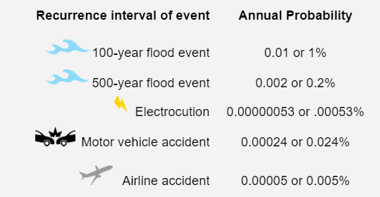
Since floods are bound to occur, it is often expressed according to their likelihood of occurring in any given year. The recurrence interval is used to calculate the likelihood or probability of occurrence of one or more floods within a year’s time frame (FEMA). The larger the number of years in a recurrence interval, the smaller the chances are of experiencing that flood within a particular year; thus, the higher the recurrence interval, the smaller the probability. The most commonly used flood risk probability is the 100-year flood, which has 1% probability of occurring in a given year.
Source: FEMA (n.d.) Flood Risk Assessment and Wilson & Crouch, 1987
Flood Inundation Maps
Inundation maps are used to show the spatial extent and the depth of flooding based on localized natural environment and built-up conditions for the given probability of a flood event. These maps convey flood severity and risk to emergency services, infrastructure, buildings, and the natural environment.
Understanding Flood Risk using the RHRT Visualization Platform
Most communities rely on FEMA maps to get flood information to support their local policy decision-making processes. However, a number of communities, especially those in rural counties, do not have access to reliable flood information due to lack of updated FEMA maps, which are less than 5 years old. To address this issue, researchers at Michigan Tech University and University of Washington, along with their civic partner-the Western Upper Peninsula Planning & Development Region have developed the Rural Hazard Resilience Tools (RHRT) to enhance flooding and coastal disaster resilience and adaptation for emergency managers, local officials, and other community members in rural communities. The team has developed an interactive online database, known as the RHRT Visualization Platform, which uses GIS and crowdsourced information on actual flooding to create inundation maps that simulate flooding and natural disasters within Baraga and Houghton counties. The tool contains layers for inland and coastal flooding, which can be used to better understand the projected impacts of future flooding. The Inland Flooding layer shows flooding extent and depth for a stage height of 3 m, which is roughly equivalent to a 500-year flood event. The Coastal Flooding layers show flooding extent for 100-year or 500-year return period events, which is indicated in the layer name.
To determine flood risk in your area of interest:
Visit https://mihazard.ml/
Zoom into your area of interest in the map
Enable (or toggle) the Inland Flooding and the Coastal Flooding (for a 100 or 500 year flood event) layers under the Project Output Layers from the Data Tab.
Click on the layers to get information on the depth of flooding anywhere in your area of interest.
Enable (or toggle) the layers in Critical Infrastructure (under Spatial Data) to study the impact of flooding on different types of critical facilities in your area of interest
Enable (or toggle) the Archived Images and Crowdsourced Photos layers in Flood Images under the Project Output Layers to access available images from previous flooding events in your area of interest. Click on the image cluster number and /or the image icon to see the image.

Flood Mitigation Strategies
Flood mitigation is a way to reduce impacts and potential loss of life and property by implementing strategies to lessen the impact of future flooding events. These strategies often require the coordination of public and/or private resources, programs, and authorities. There are many steps that communities and households can take to mitigate their flood losses:
For Communities:
Education Strategies
Conduct regular and comprehensive flood risk assessments
Perform a detailed flood risk assessment for your community using the RHRT Google Earth Engine Application. This application provides users the ability to analyze the impact of flooding on different types of structures and the overall cost of damages for their area of interest based on the selected return-period (50, 100, and 500 years).

Establish education programs to inform community members about particular risks associated with flooding and about preparedness and response strategies in the event of flooding. These programs should include guidance Establish education programs to inform community members about particular risks associated with flooding and about preparedness and response strategies in the event of flooding. These programs should include guidance on using the RHRT Visualization Platform to help people learn about their local flood risk and the Flood Photo Submission App to contribute their local knowledge for improving flood modeling in their community. Also, establish regular programs to educate people about mitigation strategies, such as retrofitting and insurance, to safeguard homes and businesses from flood damage. Refer to the next subsection on mitigation strategies recommended for households.

Increase awareness related to flood risk and mitigation strategies
Planning Strategies
Use local planning to reduce community’s flood risk
Work with local agencies and decision-makers on planning future land-use and infrastructure to steer future development away from flood prone areas, developing and maintaining green infrastructure, creating a floodplain management plan, adopting local ordinance for post-disaster recovery repairs and preventing dumping in natural water bodies.

Establish local committees to manage issues related to stormwater and ongoing flood mitigation efforts. Also, work with regional and state agencies for pooling resources and regional cooperation for flood mitigation initiatives at watershed level.

Relocate critical facilities
Improve stormwater management
Conserve floodplains as open space
Implement local building codes and standards to ensure flood protection
Construct small structural flood control measures
Elevate your home above flood elevation
Get flood insurance
Develop partnerships to facilitate flood risk reduction strategies
Site new and relocate existing critical facilities, such as police and fire stations, hospitals, and Emergency Operations Centers (EOCs), outside the flood prone areas. If relocation is not feasible, require these facilities to be constructed 1 foot above the 500-year flood elevation. Also, retrofit sewage lift stations and install back-up generators for lift and pumping stations.
Perform a storm water drainage study to identify key issues and develop and adopt a stormwater management plan and ordinance. Also, encourage the use of Low Impact Techniques.
Discourage development in floodplains by using transfer of development rights or any other compensating mechanism for land owners to ensure long-term protection of floodplains as open space.
Encourage elevation or floodproofing of both residential and non-residential structures and their utilities in your community to mitigate flood damages. While decisions related to retrofitting structures lie with property owners, communities can facilitate implementation of these strategies by expediting permits and technical assistance.
Where non-structural strategies are not feasible, use localized structural flood control measures, such as small levees.
Elevation of building structures above potential flood elevation should be considered for both existing and new developments. Use FEMA’s guide for more information on elevating your home.
A flood insurance policy is highly recommended by FEMA since it can help provide financial protection from a flood event. Damages from flooding aren’t always covered by general homeowners insurance policies. If your community participates in the NFIP program, you may be eligible to earn lower insurance rates. Multiple private insurance providers also offer flood insurance.

Conduct voluntary acquisition of structures that are located in flood-prone areas that have been frequently flooded from property owners, and demolish these structures to avoid repetitive loss and preserve the floodplain.

Natural areas close to water bodies, such as riparian buffers and wetland, prevent erosion of riverbanks, perform stormwater detention and remediation, and provide critical habitats for aquatic and amphibian species. These areas are critical for the floodplain ecosystem and therefore should be protected.

Remove frequently flooded structures
Protect and improve near-shore natural areas
Implement local building codes and standards to ensure flood protection
Perform regular maintenance of flood control structures and drainage systems
Relocate your home to areas with low flood risk
Flood Proof your home to improve flood protection


Adopt and enforce flood ASCE 24-05 Flood Resistant Design and Construction standards, require additional elevation (freeboard), or restrict first floor usage for structures in flood-prone areas


Perform regular cleaning and inspection of drainage system elements, such as stormwater drains and culverts. Inspect bridges for scours from water flow and implement strategies to prevent ice jams. Also, perform regular inspection and maintenance of all existing flood control structures, such as dams and levees.

Relocating structures is a way to help prevent future loss of the structure. Many areas are not suitable for structures – for example, locations with ongoing erosion issues – thus, if feasible, relocation to a more appropriate area should be considered.

Dry Flood-proofing strategies may be used to prevent flood water from entering the structures. Whereas, Wet Flood-proofing strategies may be used to allow flood water to enter the structure but prevent any damage by elevating critical equipment and using flood resistant materials. Please refer to FEMA’s Homeowner’s Guide to Retrofitting for more information on these development strategies


Development Strategies
Development Strategies
Financal Strategies
Flood Mitigation Grants
For Communities:
Hazard Mitigation Grant Program (HGMP)
The purpose of HMGP is to help communities implement hazard mitigation strategies following a Presidential Major Disaster Declaration. Mitigation strategies should reduce the risk of loss of life and property from future natural disasters. HMGP grants are funded by the federal government following a disaster declaration and can be available on a statewide basis.
Pre-Disaster Mitigation (PDM)
The PDM Program, is designed to assist States, U.S. Territories, Federally recognized tribes, and local communities in implementing mitigation projects before disasters occur. PDM grants are funded annually by Congressional appropriations and are awarded on a nationally competitive basis.
Flood Management Assistance (FMA)
The FMA program provides funding to states, territories, federally recognized tribes and local communities for projects that reduce long-term risk of flood damage to structures insured under the NFIP. Funding is appropriated by Congress annually and is awarded on a nationally competitive basis.
Federal Emergency Management Agency (FEMA)
U.S. Department of Housing and Urban Development
Community Development Block Grant (CDBG)
The CDBG program can fund stormwater and green infrastructure projects that mitigate flooding, improve neighborhood aesthetics, and provide other co-benefits.
Community Development Block Grant Disaster Recovery (CDBG-DR)
The CDBG-DR provides assistance for communities after a disaster occurs. Activities authorized include ones related to disaster relief, long-term recovery, restoration of infrastructure and housing, economic revitalization, and mitigation. Though CDBG-DR grants have the potential to fund a broad range of activities, CDBG–DR assistance aims to help communities and neighborhoods that otherwise might not recover due to limits on other resources.
Sustainable Communities Regional Planning Grants (SCRP)
The SCRP program places a priority on using green infrastructure to reduce flooding, improve water quality, reduce overflows and pollutants, increase resilience to storm events, and reduce impervious surfaces.
U.S. Environmental Protection Agency
Clean Water State Revolving Fund (CWSRF)
Eligible projects under CWSRF include assistance to any public, private, or nonprofit entity for measures to manage, reduce, treat, or recapture stormwater or subsurface drainage water. Financial assistance can occur as loans, purchase of debt or refinance, guarantees and insurance, guarantee of revenue debt, loan guarantees, subsidization, and earned interest.
U.S. Department of Transportation
Transportation Investment Generating Economic Recovery (TIGER) Grant
The TIGER grant funds investments in road, rail, transit and port projects, that include ones with green infrastructure components; such as stormwater drainage and reducing permeable surfaces.
National Oceanic and Atmospheric Administration
Community-Based Restoration Program
This program began in 1996 to inspire and sustain local efforts to restore coastal habitat. Eligibility for grants can vary based on which funding opportunities are available at the time of application. Grants for community resilience projects are offered. More information on NOAA’s grants can be found here.
For Households:
Federal Emergency Management Agency (FEMA)
FEMA’s Individual and Household Program (IHP)
FEMA’s IHP financial support program allows eligible individuals and households to apply for funding assistance. Eligibility includes those affected by a disaster, and those who have uninsured or under-insured necessary expenses and serious needs in response to the disaster. Provides hazard mitigation assistance to help eligible homeowners repair or rebuild stronger, more durable homes
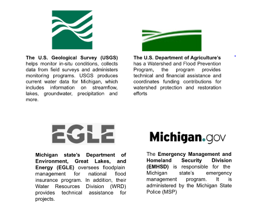
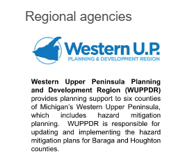
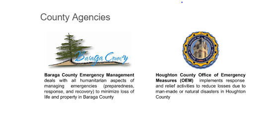
Key Agencies Involved in Flood Mitigation in the Western UP